
Thank you for supporting this site ❤️
Make a donation
Make a donation
Phon Sung topographic map
Click on the map to display elevation.
Thank you for supporting this site ❤️
Make a donation
Make a donation
About this map
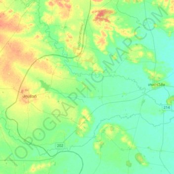
Name: Phon Sung topographic map, elevation, terrain.
Location: Phon Sung, Roi Et Province, Thailand (15.49153 103.29116 15.81153 103.61116)
Average elevation: 137 m
Minimum elevation: 125 m
Maximum elevation: 163 m
Thank you for supporting this site ❤️
Make a donation
Make a donation