
Thank you for supporting this site ❤️
Make a donation
Make a donation
Sherwood Forest NNR topographic map
Click on the map to display elevation.
Thank you for supporting this site ❤️
Make a donation
Make a donation
About this map
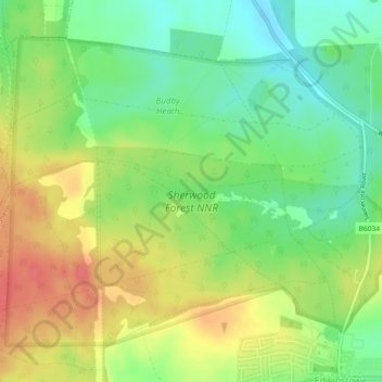
Name: Sherwood Forest NNR topographic map, elevation, terrain.
Average elevation: 71 m
Minimum elevation: 42 m
Maximum elevation: 104 m
Thank you for supporting this site ❤️
Make a donation
Make a donation
Other topographic maps
Click on a map to view its topography, its elevation and its terrain.
Sherwood Forest National Nature Reserve
United Kingdom > England > Nottinghamshire > Newark and Sherwood > Ollerton
Average elevation: 71 m