
Thank you for supporting this site ❤️
Make a donation
Make a donation
Shivari topographic map
Click on the map to display elevation.
Thank you for supporting this site ❤️
Make a donation
Make a donation
About this map
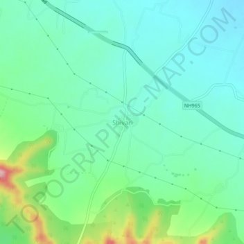
Name: Shivari topographic map, elevation, terrain.
Location: Shivari, Purandhar, Pune District, Maharashtra, India (18.27819 74.06968 18.31819 74.10968)
Average elevation: 759 m
Minimum elevation: 712 m
Maximum elevation: 900 m
Thank you for supporting this site ❤️
Make a donation
Make a donation
Other topographic maps
Click on a map to view its topography, its elevation and its terrain.