
Thank you for supporting this site ❤️
Make a donation
Make a donation
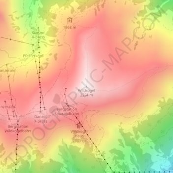
Wildkogel topographic map
Click on the map to display elevation.
Thank you for supporting this site ❤️
Make a donation
Make a donation
Wildkogel
Der Berg liegt in der Region Oberpinzgau, nördlich des west-östlich verlaufenden Salzachtals. Seine Nordflanke fällt hinab ins Mühlbachtal, der Ostnordostgrat verläuft bis zur Filzenhöhe (1921 m), die Südseite zieht sich zur Salzach hinunter und der Westgrat läuft hinab zum Dürnbachtal. Nächstgelegene Orte sind Neukirchen und Bramberg in etwa dreieinhalb Kilometer Luftlinie.
Thank you for supporting this site ❤️
Make a donation
Make a donation
About this map
Name: Wildkogel topographic map, elevation, terrain.
Average elevation: 1,882 m
Minimum elevation: 1,302 m
Maximum elevation: 2,215 m
Thank you for supporting this site ❤️
Make a donation
Make a donation