
Thank you for supporting this site ❤️
Make a donation
Make a donation
Sebatu topographic map
Click on the map to display elevation.
Thank you for supporting this site ❤️
Make a donation
Make a donation
About this map
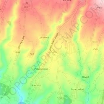
Name: Sebatu topographic map, elevation, terrain.
Location: Sebatu, Gianyar, Bali, Nusa Tenggara, 80572, Indonesien (-8.42382 115.26892 -8.38382 115.30892)
Average elevation: 551 m
Minimum elevation: 412 m
Maximum elevation: 667 m
Thank you for supporting this site ❤️
Make a donation
Make a donation
Other topographic maps
Click on a map to view its topography, its elevation and its terrain.