
Thank you for supporting this site ❤️
Make a donation
Make a donation
Oturehua topographic map
Click on the map to display elevation.
Thank you for supporting this site ❤️
Make a donation
Make a donation
About this map
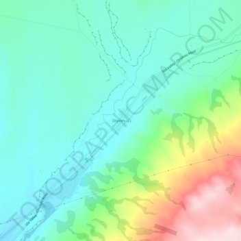
Name: Oturehua topographic map, elevation, terrain.
Location: Oturehua, Central Otago District, New Zealand (-45.02699 169.89302 -44.98699 169.93302)
Average elevation: 569 m
Minimum elevation: 476 m
Maximum elevation: 814 m
Thank you for supporting this site ❤️
Make a donation
Make a donation
Other topographic maps
Click on a map to view its topography, its elevation and its terrain.