
Thank you for supporting this site ❤️
Make a donation
Make a donation
La Plaine Chabrier topographic map
Click on the map to display elevation.
Thank you for supporting this site ❤️
Make a donation
Make a donation
About this map
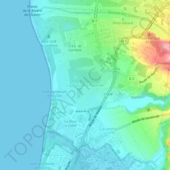
Name: La Plaine Chabrier topographic map, elevation, terrain.
Location: La Plaine Chabrier, Saint-Paul, Réunion, 97863, France (-20.99451 55.27122 -20.95451 55.31122)
Average elevation: 26 m
Minimum elevation: -1 m
Maximum elevation: 136 m
Thank you for supporting this site ❤️
Make a donation
Make a donation