
Make a donation
Harter Fell topographic map
Click on the map to display elevation.
Make a donation
Harter Fell
Harter Fell offers excellent insights into the structure and composition of the Birker Fell formation of the Ordovician Borrowdale Volcanic Group. The fell is dominantly composed of composite andesite lava flows, with autobrecciated upper surfaces developed in some locations. These are often seen in the field as flat surfaces above steep crags, the crags themselves being formed due to the more crystalline, lower portions of each flow. The dip slope on these flows (~24° WSW) suggests that the formation is in nearly the same orientation now as when it formed. The summit of the fell is composed of one such lava flow, but only a few metres down slope the underlying lava flow is a portion of the Great Whinscale Dacite. This local marker unit conformably overlies an andesitic lapilli tuff and the Little Stand Tuff, a nodular rhyolitic ignimbrite. Below these distinctive rock units the andesite lava flows are seen again. On the northern side of the fell, at approximately 520 – 540 m elevation, a volcaniclastic sandstone unit is intercalated between the flows. Also on the northern slopes of the fell, and lower still at between 450 – 500 m, the lava flows switch to dacitic composition, with distinctive euhedral plagioclase feldspar phenocrysts (1 – 4 mm). The southern slopes of the fell again display the Great Whinscale dacite-tuff sequence, owing to extensive faulting. The very lowest slopes of the fell again revert to andesitic lava flows. In the north-western corner, near the Spothow Gill, a small vein of copper mineralisation has been worked out, and some of the evidence of this Victorian-era mining activity can still be seen.
Make a donation
About this map
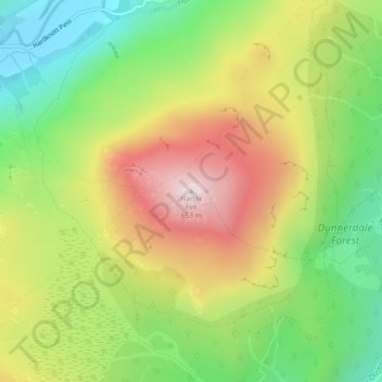
Name: Harter Fell topographic map, elevation, terrain.
Average elevation: 335 m
Minimum elevation: 81 m
Maximum elevation: 642 m
Make a donation
Other topographic maps
Click on a map to view its topography, its elevation and its terrain.
Crinkle Crags
United Kingdom > England > Cumberland > Ulpha
In recent times more systematic hill lists have been produced based upon topographical prominence and height, rather than mere visual appeal. Most relevant to Crinkle Crags are the lists of Hewitts and Nuttalls. These variously list the summit, the first Crinkle (Crinkle Crags South Top), and two tops on…
Average elevation: 566 m
Devoke Water
United Kingdom > England > Cumberland > Ulpha
Devoke Water is a small lake in the south west of the Lake District in North West England. It is the largest tarn in the Lake District, a tarn being a specific type of glacial lake formed when a hollow is created on a mountain. The lake is 1.17 kilometres (0.73 mi) long, has an area of 0.34 square kilometres…
Average elevation: 260 m
Make a donation