
Thank you for supporting this site ❤️
Make a donation
Make a donation
Alandi topographic map
Click on the map to display elevation.
Thank you for supporting this site ❤️
Make a donation
Make a donation
Alandi
Alandi (18°40′37.42″N 73°53′47.76″E / 18.6770611°N 73.8966000°E / 18.6770611; 73.8966000) is located on the bank of the Indrayani River, 18.8 km (11.7 mi) from Khed Taluka of Pune District, near the northern edge of the city of Pune. Alandi has an average elevation of 577 meters (1,893 feet).
Thank you for supporting this site ❤️
Make a donation
Make a donation
About this map
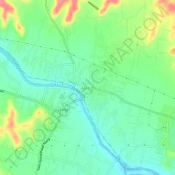
Name: Alandi topographic map, elevation, terrain.
Location: Alandi, Khed, Pune District, Maharashtra, 412105, India (18.65724 73.87811 18.69724 73.91811)
Average elevation: 578 m
Minimum elevation: 552 m
Maximum elevation: 631 m
Thank you for supporting this site ❤️
Make a donation
Make a donation
Other topographic maps
Click on a map to view its topography, its elevation and its terrain.