
Thank you for supporting this site ❤️
Make a donation
Make a donation
Al Aaqaby topographic map
Click on the map to display elevation.
Thank you for supporting this site ❤️
Make a donation
Make a donation
About this map
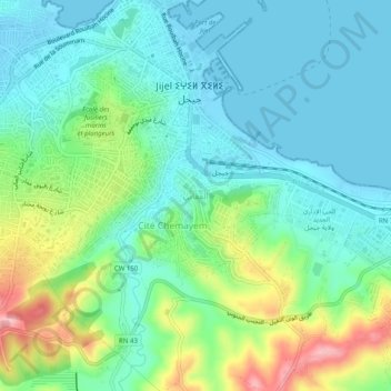
Name: Al Aaqaby topographic map, elevation, terrain.
Location: Al Aaqaby, Jijel, Jijel District, Jijel, 18000, Algeria (36.78601 5.75222 36.82601 5.79222)
Average elevation: 42 m
Minimum elevation: -3 m
Maximum elevation: 155 m
Thank you for supporting this site ❤️
Make a donation
Make a donation
Other topographic maps
Click on a map to view its topography, its elevation and its terrain.