
Thank you for supporting this site ❤️
Make a donation
Make a donation
Rebgeshain topographic map
Click on the map to display elevation.
Thank you for supporting this site ❤️
Make a donation
Make a donation
Rebgeshain
Die Statistisch-topographisch-historische Beschreibung des Großherzogthums Hessen berichtet 1830 über Rebgeshain.
Thank you for supporting this site ❤️
Make a donation
Make a donation
About this map
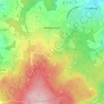
Name: Rebgeshain topographic map, elevation, terrain.
Location: Rebgeshain, Ulrichstein, Vogelsbergkreis, Hessen, Deutschland (50.53826 9.21890 50.58176 9.25727)
Average elevation: 624 m
Minimum elevation: 512 m
Maximum elevation: 752 m
Thank you for supporting this site ❤️
Make a donation
Make a donation