
Dietersheim topographic map
Interactive map
Click on the map to display elevation.
About this map
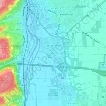
Name: Dietersheim topographic map, elevation, terrain.
Average elevation: 106 m
Minimum elevation: 82 m
Maximum elevation: 216 m
Other topographic maps
Click on a map to view its topography, its elevation and its terrain.
Sponsheim
Deutschland > Rheinland-Pfalz > Bingen am Rhein
Sponsheim, Bingen am Rhein, Landkreis Mainz-Bingen, Rheinland-Pfalz, Deutschland
Average elevation: 96 m
Dromersheim
Deutschland > Rheinland-Pfalz > Bingen am Rhein
Dromersheim, Bingen am Rhein, Landkreis Mainz-Bingen, Rheinland-Pfalz, Deutschland
Average elevation: 152 m