
Thank you for supporting this site ❤️
Make a donation
Make a donation
Tunjungan topographic map
Click on the map to display elevation.
Thank you for supporting this site ❤️
Make a donation
Make a donation
About this map
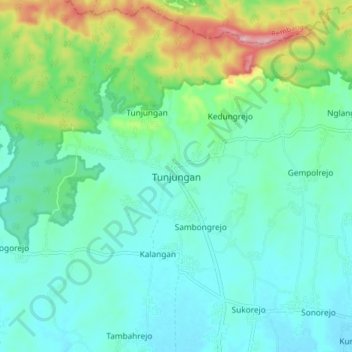
Name: Tunjungan topographic map, elevation, terrain.
Location: Tunjungan, Blora, Central Java, Java, Indonesia (-6.96283 111.33022 -6.88283 111.41022)
Average elevation: 128 m
Minimum elevation: 86 m
Maximum elevation: 267 m
Thank you for supporting this site ❤️
Make a donation
Make a donation