
Thank you for supporting this site ❤️
Make a donation
Make a donation
Ingate topographic map
Click on the map to display elevation.
Thank you for supporting this site ❤️
Make a donation
Make a donation
About this map
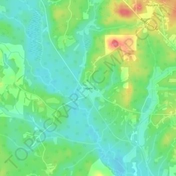
Name: Ingate topographic map, elevation, terrain.
Location: Ingate, Bibb County, Alabama, 35034, United States (32.94846 -87.23583 32.98846 -87.19583)
Average elevation: 89 m
Minimum elevation: 62 m
Maximum elevation: 147 m
Thank you for supporting this site ❤️
Make a donation
Make a donation
Other topographic maps
Click on a map to view its topography, its elevation and its terrain.