
Thank you for supporting this site ❤️
Make a donation
Make a donation
La Huaca topographic map
Click on the map to display elevation.
Thank you for supporting this site ❤️
Make a donation
Make a donation
About this map
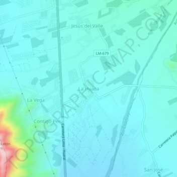
Name: La Huaca topographic map, elevation, terrain.
Location: La Huaca, Huaral, Lima, Perú (-11.54650 -77.21857 -11.50650 -77.17857)
Average elevation: 187 m
Minimum elevation: 133 m
Maximum elevation: 561 m
Thank you for supporting this site ❤️
Make a donation
Make a donation
Other topographic maps
Click on a map to view its topography, its elevation and its terrain.