
Make a donation
Eagle Lake topographic map
Click on the map to display elevation.
Make a donation
About this map
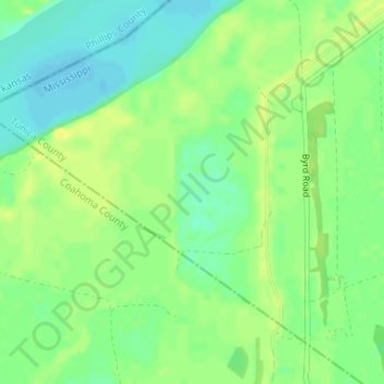
Name: Eagle Lake topographic map, elevation, terrain.
Location: Eagle Lake, Tunica County, Mississippi, United States (34.52005 -90.54960 34.52015 -90.54950)
Average elevation: 54 m
Minimum elevation: 43 m
Maximum elevation: 63 m
Make a donation
Other topographic maps
Click on a map to view its topography, its elevation and its terrain.
Diamondhead
United States > Mississippi > Hancock County
Much of the land that became Diamondhead had been purchased by Walter Gex, Sr., in 1937 from the Gulf State Paper Company and the Easy Opener Bag Company. Additional land was purchased by Gex, bringing his acquisition to nearly 5,000 acres (2,000 ha). In the late 1960s, D.E.A.R., Inc., later known as the…
Average elevation: 3 m
Make a donation
Make a donation
Make a donation
Lake Catherine
United States > Mississippi > Hinds County > Jackson > Lost Lake
Average elevation: 100 m
Bay of Saint Louis
United States > Mississippi > Harrison County > Pass Christian
Average elevation: 4 m
Make a donation
Make a donation
Make a donation
Make a donation
Make a donation
Make a donation
Make a donation
Make a donation
Make a donation
Make a donation
Make a donation
Bell-Sandifer Leisure Park
United States > Mississippi > Forrest County > Hattiesburg
Average elevation: 49 m
Make a donation
Make a donation
Make a donation
Diamondhead
Much of the land that became Diamondhead had been purchased by Walter Gex Sr., in 1937 from the Gulf State Paper Company and the Easy Opener Bag Company. Additional land was purchased by Gex, bringing his acquisition to nearly 5,000 acres (2,000 ha). In the late 1960s, D.E.A.R., Inc., later known as the…
Average elevation: 4 m
Make a donation
Make a donation
Latimer
United States > Mississippi > Jackson County > Martins Pine Hill Estates
Average elevation: 12 m
Make a donation
Make a donation
Make a donation
Make a donation
Make a donation
Make a donation