
Gause topographic map
Click on the map to display elevation.
About this map
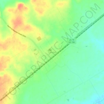
Name: Gause topographic map, elevation, terrain.
Location: Gause, Milam County, Texas, 77857, United States (30.76748 -96.74094 30.80748 -96.70094)
Average elevation: 114 m
Minimum elevation: 93 m
Maximum elevation: 140 m
Other topographic maps
Click on a map to view its topography, its elevation and its terrain.