
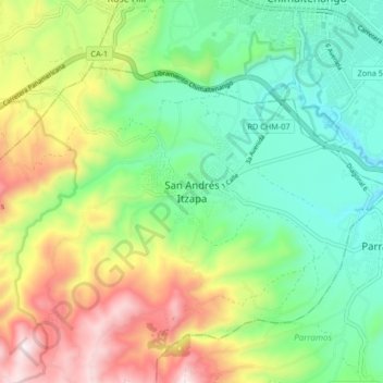
San Andrés Itzapa topographic map
Interactive map
Click on the map to display elevation.
About this map
Name: San Andrés Itzapa topographic map, elevation, terrain.
Location: San Andrés Itzapa, Chimaltenango, Guatemala (14.58078 -90.88413 14.66078 -90.80413)
Average elevation: 1,968 m
Minimum elevation: 1,689 m
Maximum elevation: 2,461 m