
Thank you for supporting this site ❤️
Make a donation
Make a donation
Johor River topographic map
Click on the map to display elevation.
Thank you for supporting this site ❤️
Make a donation
Make a donation
About this map
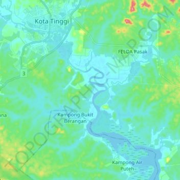
Name: Johor River topographic map, elevation, terrain.
Location: Johor River, Pasir Gudang, Johor, 81700, Malaysia (1.62347 103.85691 1.74807 103.97422)
Average elevation: 19 m
Minimum elevation: -4 m
Maximum elevation: 117 m
Thank you for supporting this site ❤️
Make a donation
Make a donation
Other topographic maps
Click on a map to view its topography, its elevation and its terrain.