
Sungai Petani topographic map
Interactive map
Click on the map to display elevation.
About this map
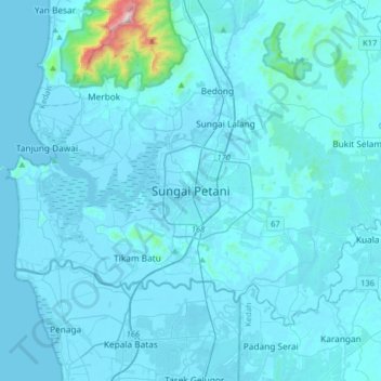
Name: Sungai Petani topographic map, elevation, terrain.
Location: Sungai Petani, Kuala Muda, Kedah, 08000, Malaysia (5.48352 100.32695 5.80352 100.64695)
Average elevation: 45 m
Minimum elevation: -2 m
Maximum elevation: 1,169 m
Other topographic maps
Click on a map to view its topography, its elevation and its terrain.
Kampung Baru Bagan Samak
Malaysia > Kedah > Permatang Kerat Telunjuk > Kampung Baru Bagan Samak
Average elevation: 3 m
Kemajuan Tanah (FELDA) Lubok Merbau
Malaysia > Kedah > Kemajuan Tanah (FELDA) Lubok Merbau
Average elevation: 60 m