
Thank you for supporting this site ❤️
Make a donation
Make a donation
Kattaikonam topographic map
Click on the map to display elevation.
Thank you for supporting this site ❤️
Make a donation
Make a donation
About this map
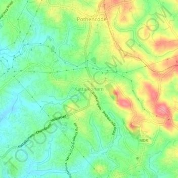
Name: Kattaikonam topographic map, elevation, terrain.
Location: Kattaikonam, Thiruvananthapuram, Kerala, 695584, India (8.58267 76.87707 8.62267 76.91707)
Average elevation: 52 m
Minimum elevation: 16 m
Maximum elevation: 107 m
Thank you for supporting this site ❤️
Make a donation
Make a donation
Other topographic maps
Click on a map to view its topography, its elevation and its terrain.
Thank you for supporting this site ❤️
Make a donation
Make a donation
Thank you for supporting this site ❤️
Make a donation
Make a donation