
Thank you for supporting this site ❤️
Make a donation
Make a donation
Begi Akorino topographic map
Click on the map to display elevation.
Thank you for supporting this site ❤️
Make a donation
Make a donation
About this map
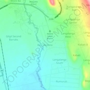
Name: Begi Akorino topographic map, elevation, terrain.
Location: Begi Akorino, Morendat ward, Gilgil, Nakuru, 20116, Kenya (-0.53164 36.33576 -0.49164 36.37576)
Average elevation: 1,994 m
Minimum elevation: 1,954 m
Maximum elevation: 2,115 m
Thank you for supporting this site ❤️
Make a donation
Make a donation