
Thank you for supporting this site ❤️
Make a donation
Make a donation
Tabunger Gaqaa topographic map
Click on the map to display elevation.
Thank you for supporting this site ❤️
Make a donation
Make a donation
About this map
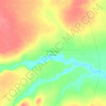
Name: Tabunger Gaqaa topographic map, elevation, terrain.
Location: Tabunger Gaqaa, Tongliao City, Inner Mongolia, China (42.78198 121.73204 42.82198 121.77204)
Average elevation: 276 m
Minimum elevation: 234 m
Maximum elevation: 310 m
Thank you for supporting this site ❤️
Make a donation
Make a donation
Other topographic maps
Click on a map to view its topography, its elevation and its terrain.