
Thank you for supporting this site ❤️
Make a donation
Make a donation
Satun topographic map
Click on the map to display elevation.
Thank you for supporting this site ❤️
Make a donation
Make a donation
About this map
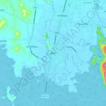
Name: Satun topographic map, elevation, terrain.
Location: Satun, Mueang Satun, Satun Province, Thailand (6.57516 100.02644 6.65516 100.10644)
Average elevation: 11 m
Minimum elevation: -1 m
Maximum elevation: 215 m
Thank you for supporting this site ❤️
Make a donation
Make a donation
Other topographic maps
Click on a map to view its topography, its elevation and its terrain.