
Rasdorf topographic map
Interactive map
Click on the map to display elevation.
About this map
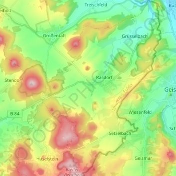
Name: Rasdorf topographic map, elevation, terrain.
Location: Rasdorf, Landkreis Fulda, Hesse, 36169, Allemagne (50.67346 9.85025 50.75783 9.94150)
Average elevation: 363 m
Minimum elevation: 257 m
Maximum elevation: 556 m