
Thank you for supporting this site ❤️
Make a donation
Make a donation
Borehole topographic map
Click on the map to display elevation.
Thank you for supporting this site ❤️
Make a donation
Make a donation
About this map
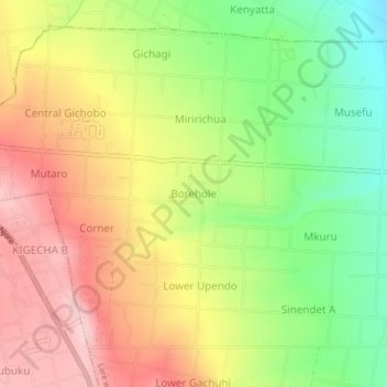
Name: Borehole topographic map, elevation, terrain.
Location: Borehole, Lare ward, Njoro, Nakuru, 20106, Kenya (-0.41401 35.96045 -0.37401 36.00045)
Average elevation: 2,155 m
Minimum elevation: 2,040 m
Maximum elevation: 2,265 m
Thank you for supporting this site ❤️
Make a donation
Make a donation