
Thank you for supporting this site ❤️
Make a donation
Make a donation
Xudun topographic map
Click on the map to display elevation.
Thank you for supporting this site ❤️
Make a donation
Make a donation
About this map
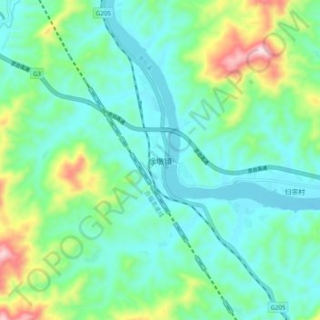
Name: Xudun topographic map, elevation, terrain.
Location: Xudun, Nanping City, Fujian, China (27.09832 118.19468 27.17832 118.27468)
Average elevation: 211 m
Minimum elevation: 98 m
Maximum elevation: 578 m
Thank you for supporting this site ❤️
Make a donation
Make a donation
Other topographic maps
Click on a map to view its topography, its elevation and its terrain.