
Thank you for supporting this site ❤️
Make a donation
Make a donation
Adamsville topographic map
Click on the map to display elevation.
Thank you for supporting this site ❤️
Make a donation
Make a donation
About this map
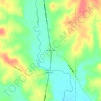
Name: Adamsville topographic map, elevation, terrain.
Location: Adamsville, Lampasas County, Texas, United States (31.28128 -98.18892 31.32128 -98.14892)
Average elevation: 336 m
Minimum elevation: 309 m
Maximum elevation: 372 m
Thank you for supporting this site ❤️
Make a donation
Make a donation
Other topographic maps
Click on a map to view its topography, its elevation and its terrain.