
San Luis topographic map
Interactive map
Click on the map to display elevation.
About this map
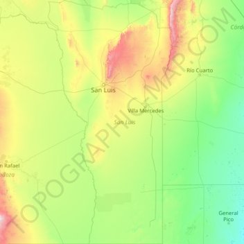
Name: San Luis topographic map, elevation, terrain.
Location: San Luis, Argentina (-36.00063 -67.47610 -31.83380 -64.89974)
Average elevation: 492 m
Minimum elevation: 114 m
Maximum elevation: 3,132 m
Other topographic maps
Click on a map to view its topography, its elevation and its terrain.
Municipio de Carpintería
Municipio de Carpintería, Junín, San Luis, Argentina
Average elevation: 1,029 m