
Arrou topographic map
Interactive map
Click on the map to display elevation.
About this map
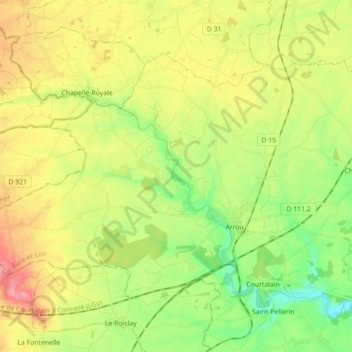
Name: Arrou topographic map, elevation, terrain.
Average elevation: 170 m
Minimum elevation: 127 m
Maximum elevation: 225 m
Other topographic maps
Click on a map to view its topography, its elevation and its terrain.
Langey
France > Centre-Val de Loire > Eure-et-Loir > Vald'Yerre
Langey, Vald'Yerre, Châteaudun, Eure-et-Loir, Centre-Val de Loire, France métropolitaine, 28220, France
Average elevation: 146 m