
Thank you for supporting this site ❤️
Make a donation
Make a donation
Viramgam topographic map
Click on the map to display elevation.
Thank you for supporting this site ❤️
Make a donation
Make a donation
Viramgam
Viramgam is located at 23°07′N 72°02′E / 23.12°N 72.03°E / 23.12; 72.03. It has an average elevation of 32 metres (105 ft). The old town of Viramgam is surrounded by a rectangular, tower flanked brick and stone wall, about 21 miles round.
Thank you for supporting this site ❤️
Make a donation
Make a donation
About this map
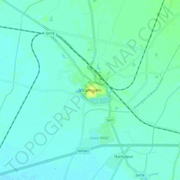
Name: Viramgam topographic map, elevation, terrain.
Location: Viramgam, Viramgam Taluka, Ahmedabad, Gujarat, 382150, India (23.08245 72.00839 23.16245 72.08839)
Average elevation: 28 m
Minimum elevation: 24 m
Maximum elevation: 39 m
Thank you for supporting this site ❤️
Make a donation
Make a donation