
Keady Beg topographic map
Interactive map
Click on the map to display elevation.
About this map
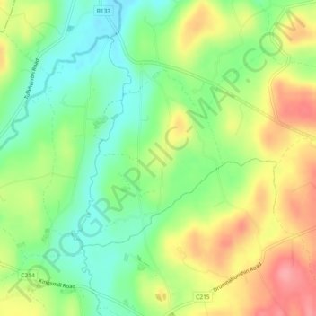
Name: Keady Beg topographic map, elevation, terrain.
Average elevation: 106 m
Minimum elevation: 64 m
Maximum elevation: 160 m
Other topographic maps
Click on a map to view its topography, its elevation and its terrain.
Corlat
Royaume-Uni > Irlande du Nord > Whitecross
Corlat, Whitecross, County Armagh, Irlande du Nord, Royaume-Uni
Average elevation: 123 m