
Thank you for supporting this site ❤️
Make a donation
Make a donation
Don topographic map
Click on the map to display elevation.
Thank you for supporting this site ❤️
Make a donation
Make a donation
About this map
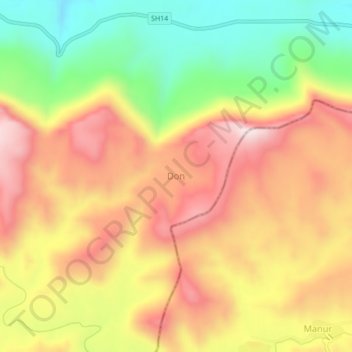
Name: Don topographic map, elevation, terrain.
Location: Don, Ahava Taluka, Dang, Gujarat, India (20.70413 73.84549 20.74413 73.88549)
Average elevation: 850 m
Minimum elevation: 566 m
Maximum elevation: 1,098 m
Thank you for supporting this site ❤️
Make a donation
Make a donation