
Thank you for supporting this site ❤️
Make a donation
Make a donation
Rorup topographic map
Click on the map to display elevation.
Thank you for supporting this site ❤️
Make a donation
Make a donation
About this map
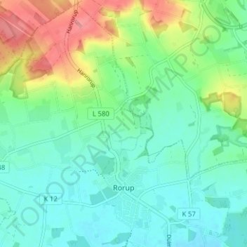
Name: Rorup topographic map, elevation, terrain.
Location: Rorup, Dülmen, Kreis Coesfeld, Nordrhein-Westfalen, Deutschland (51.88851 7.22655 51.92626 7.28920)
Average elevation: 100 m
Minimum elevation: 72 m
Maximum elevation: 167 m
Thank you for supporting this site ❤️
Make a donation
Make a donation
Other topographic maps
Click on a map to view its topography, its elevation and its terrain.
Limbergen
Deutschland > Nordrhein-Westfalen > Kreis Coesfeld > Dülmen > Buldern
Average elevation: 76 m