
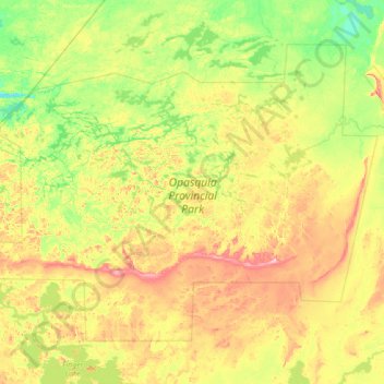
Opasquia Provincial Park topographic map
Interactive map
Click on the map to display elevation.
About this map
Name: Opasquia Provincial Park topographic map, elevation, terrain.
Average elevation: 282 m
Minimum elevation: 225 m
Maximum elevation: 407 m
Other topographic maps
Click on a map to view its topography, its elevation and its terrain.
Sunday Lake
Canada > Ontario > Unorganized Kenora District
Sunday Lake, Highway 665, Unorganized Kenora District, Kenora District, Ontario, Canada
Average elevation: 399 m
Anishinabi Lake
Canada > Ontario > Unorganized Kenora District
Anishinabi Lake, Unorganized Kenora District, Kenora District, Ontario, Canada
Average elevation: 374 m
White Otter Lake
Canada > Ontario > Unorganized Kenora District
White Otter Lake, Unorganized Kenora District, Kenora District, Ontario, Canada
Average elevation: 439 m