
停车场 topographic map
Interactive map
Click on the map to display elevation.
About this map
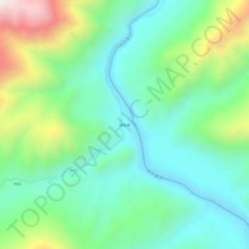
Name: 停车场 topographic map, elevation, terrain.
Location: 停车场, 禾木哈纳斯蒙古民族乡, 布尔津县, 阿勒泰地区, Xinjiang, Chine (48.42877 87.31037 48.46877 87.35037)
Average elevation: 1,216 m
Minimum elevation: 938 m
Maximum elevation: 1,901 m
Other topographic maps
Click on a map to view its topography, its elevation and its terrain.
Lac Kanas
Chine > Xinjiang > 布尔津县 > 禾木哈纳斯蒙古民族乡
Lac Kanas, 禾木哈纳斯蒙古民族乡, 布尔津县, 阿勒泰地区, Xinjiang, Chine
Average elevation: 1,896 m