
Noah topographic map
Interactive map
Click on the map to display elevation.
About this map
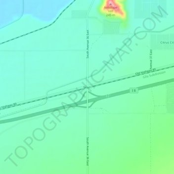
Name: Noah topographic map, elevation, terrain.
Location: Noah, Yuma County, Arizona, États-Unis d'Amérique (32.66477 -114.04216 32.70477 -114.00216)
Average elevation: 106 m
Minimum elevation: 72 m
Maximum elevation: 231 m
Other topographic maps
Click on a map to view its topography, its elevation and its terrain.
Buckshot
États-Unis d'Amérique > Arizona > Yuma County
Buckshot, Yuma County, Arizona, États-Unis d'Amérique
Average elevation: 52 m