
Thank you for supporting this site ❤️
Make a donation
Make a donation
Remouchamps topographic map
Click on the map to display elevation.
Thank you for supporting this site ❤️
Make a donation
Make a donation
About this map
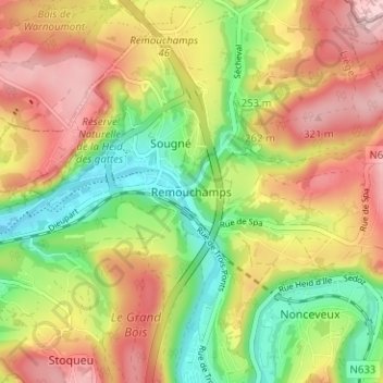
Name: Remouchamps topographic map, elevation, terrain.
Location: Remouchamps, Aywaille, Liège, Wallonie, 4920, Belgique (50.45948 5.69260 50.49948 5.73260)
Average elevation: 222 m
Minimum elevation: 120 m
Maximum elevation: 323 m
Thank you for supporting this site ❤️
Make a donation
Make a donation
Other topographic maps
Click on a map to view its topography, its elevation and its terrain.