
Walternienburg topographic map
Interactive map
Click on the map to display elevation.
About this map
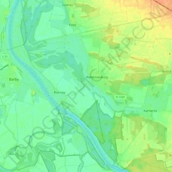
Name: Walternienburg topographic map, elevation, terrain.
Average elevation: 56 m
Minimum elevation: 43 m
Maximum elevation: 78 m
Other topographic maps
Click on a map to view its topography, its elevation and its terrain.
Quast
Deutschland > Sachsen-Anhalt > Anhalt-Bitterfeld > Zerbst/Anhalt
Quast, Zerbst/Anhalt, Anhalt-Bitterfeld, Sachsen-Anhalt, 39264, Deutschland
Average elevation: 83 m