
Ehlhalten topographic map
Interactive map
Click on the map to display elevation.
About this map
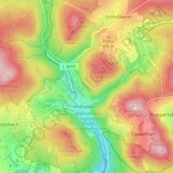
Name: Ehlhalten topographic map, elevation, terrain.
Average elevation: 363 m
Minimum elevation: 215 m
Maximum elevation: 503 m
Other topographic maps
Click on a map to view its topography, its elevation and its terrain.
Niederjosbach
Deutschland > Hessen > Eppstein > Niederjosbach
Niederjosbach, Eppstein, Main-Taunus-Kreis, Hessen, Deutschland
Average elevation: 281 m