
El Gomeral topographic map
Interactive map
Click on the map to display elevation.
About this map
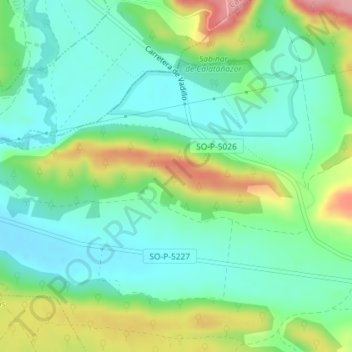
Name: El Gomeral topographic map, elevation, terrain.
Location: El Gomeral, Calatañazor, Sória, Castela e Leão, 42193, Espanha (41.69830 -2.85422 41.71830 -2.83422)
Average elevation: 1,030 m
Minimum elevation: 990 m
Maximum elevation: 1,114 m