
Cottesmore topographic map
Interactive map
Click on the map to display elevation.
About this map
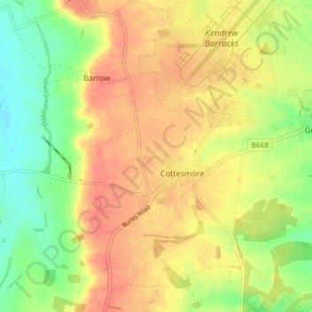
Name: Cottesmore topographic map, elevation, terrain.
Location: Cottesmore, Rutland, East Midlands, England, United Kingdom (52.70124 -0.70539 52.73061 -0.63181)
Average elevation: 128 m
Minimum elevation: 97 m
Maximum elevation: 151 m