
Wahpeton topographic map
Interactive map
Click on the map to display elevation.
About this map
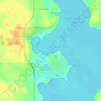
Name: Wahpeton topographic map, elevation, terrain.
Location: Wahpeton, Dickinson County, Iowa, USA (43.35703 -95.18543 43.39647 -95.15812)
Average elevation: 435 m
Minimum elevation: 424 m
Maximum elevation: 458 m