
Santa Teresa topographic map
Interactive map
Click on the map to display elevation.
About this map
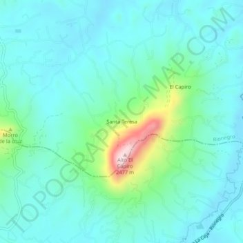
Name: Santa Teresa topographic map, elevation, terrain.
Location: Santa Teresa, Rionegro, Oriente, Antioquia, 054037, Colombia (6.04943 -75.42534 6.08943 -75.38534)
Average elevation: 2,171 m
Minimum elevation: 2,102 m
Maximum elevation: 2,471 m