
Rulle Crotte topographic map
Interactive map
Click on the map to display elevation.
About this map
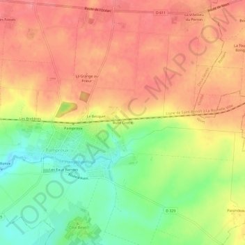
Name: Rulle Crotte topographic map, elevation, terrain.
Average elevation: 127 m
Minimum elevation: 82 m
Maximum elevation: 158 m
Other topographic maps
Click on a map to view its topography, its elevation and its terrain.
Les Eaux Barrées
France > Nouvelle-Aquitaine > Deux-Sèvres > Pamproux
Les Eaux Barrées, Pamproux, Niort, Deux-Sèvres, Nouvelle-Aquitaine, France métropolitaine, 79800, France
Average elevation: 113 m