
La Coxa topographic map
Interactive map
Click on the map to display elevation.
About this map
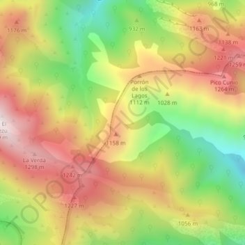
Name: La Coxa topographic map, elevation, terrain.
Location: La Coxa, Ponga, Astúrias, Espanha (43.25143 -5.28527 43.27143 -5.26527)
Average elevation: 979 m
Minimum elevation: 568 m
Maximum elevation: 1,349 m