
Thank you for supporting this site ❤️
Make a donation
Make a donation
Hüttlenen topographic map
Click on the map to display elevation.
Thank you for supporting this site ❤️
Make a donation
Make a donation
About this map
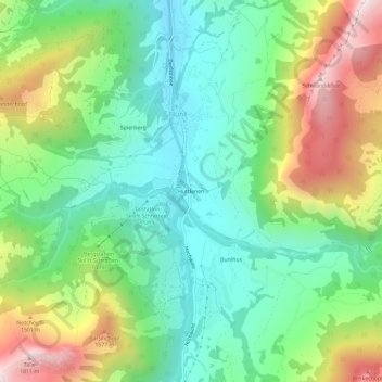
Name: Hüttlenen topographic map, elevation, terrain.
Location: Hüttlenen, Flühli, Lucerne, 6173, Suisse (46.85591 7.99761 46.89591 8.03761)
Average elevation: 1,186 m
Minimum elevation: 855 m
Maximum elevation: 1,813 m
Thank you for supporting this site ❤️
Make a donation
Make a donation