
Cedros topographic map
Interactive map
Click on the map to display elevation.
About this map
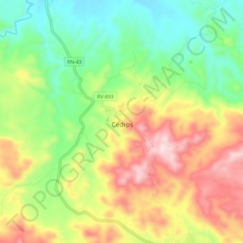
Name: Cedros topographic map, elevation, terrain.
Location: Cedros, Francisco Morazán, Honduras (14.55646 -87.15882 14.63646 -87.07882)
Average elevation: 868 m
Minimum elevation: 629 m
Maximum elevation: 1,202 m