
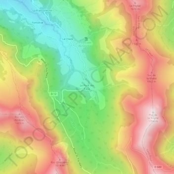
Le Pont des Eaux topographic map
Interactive map
Click on the map to display elevation.
About this map
Name: Le Pont des Eaux topographic map, elevation, terrain.
Average elevation: 1,290 m
Minimum elevation: 898 m
Maximum elevation: 1,689 m
Other topographic maps
Click on a map to view its topography, its elevation and its terrain.
Puy Mary
France > Auvergne-Rhône-Alpes > Cantal > Le Falgoux
Puy Mary, Le Falgoux, Mauriac, Cantal, Auvergne-Rhône-Alpes, France métropolitaine, 15380, France
Average elevation: 1,413 m
Le Cher Soubro
France > Auvergne-Rhône-Alpes > Cantal > Le Falgoux
Le Cher Soubro, Le Falgoux, Mauriac, Cantal, Auvergne-Rhône-Alpes, France métropolitaine, 15380, France
Average elevation: 1,181 m