
Manderveen topographic map
Interactive map
Click on the map to display elevation.
About this map
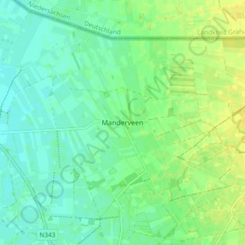
Name: Manderveen topographic map, elevation, terrain.
Location: Manderveen, Overijssel, Niederlande, 7664, Niederlande (52.42582 6.75780 52.46582 6.79780)
Average elevation: 23 m
Minimum elevation: 15 m
Maximum elevation: 33 m